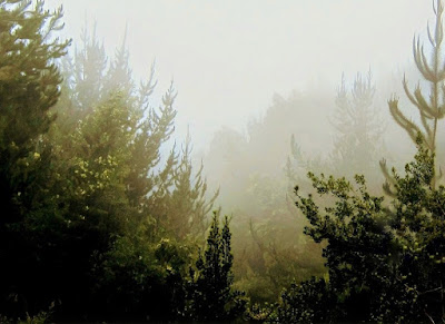
The photo at the top of this post shows me on a ridge section of the Halemau'u Trail, Haleakala National Park. Dwight is manning both the camera and backpack.
The hike started above the clouds at 8,000 feet, then we zigged and zagged to the bottom of a crater.
Another day, starting in the clouds at 6,000 feet, we walked the Boundary Trail, Polipoli Spring State Recreation Area.
To get to the trailhead we abandoned the car, and walked half a mile on an undrivable 4-wheel track.
Our final upcountry hike was in Waihou Spring Forest Reserve. We were surprised by the quality and choice of trails. We found a trail that required a bit of effort, which was exactly what we wanted.
At the turnaround point we reached a cliff pocked with caves.
We relocated from an upcountry cottage to an AirBnB on a hillside overlooking Wailea, southwest Maui. Trails are in short supply in this area, but we found some adequate hikes nonetheless.
Our first hike in this area was the coastal section of the Hoapili Trail.
Much of the walk is on lava from an eruption circa 1790.
At the turnaround point we reached the Pacific where white pieces of coral met the black lava.
Another day we walked part of the King's Highway section of the Hoapili Trail.
Some of the hike was on a'a lava scree. We walked slowly, and were glad of the stability of our boots.
We revisited the Lahaina Pali Trail. Last week we started at the northern trailhead. This time we chose the southern trailhead because it was closer to where we were staying.
We walked up to a wind farm. On the way back down we had great views of Maalaea Bay and Haleakala.
The remaining hikes this past week were basically strolls, easily extended with beach walks.
 |
| Kealia Coastal Boardwalk |
 |
| Wailea Beach Path |


No comments:
Post a Comment